Bathymetry | Teqroniqh Trading & Technical Services Co. WLL
Bathymetry
Precision Bathymetric Survey Solutions for Marine and Coastal Applications
At Teqroniqh Trading & Technical Services Co. WLL, we provide precision bathymetric survey solutions for accurate underwater topography mapping in marine, coastal, and inland water environments. Our expertise in bathymetry enables high-resolution seabed mapping for a wide range of engineering, environmental, and scientific applications.
Bathymetric data is essential for understanding underwater terrain, supporting navigation safety, and planning marine infrastructure. Our survey solutions deliver detailed depth measurements and seafloor characterization that inform critical decision-making.
With advanced survey equipment, experienced hydrographers, and comprehensive data processing capabilities, we deliver customized bathymetric solutions that meet the unique requirements of every project.
Precision Survey High-Resolution Mapping Accurate Depth Data
Bathymetric survey vessel and equipment at sea
Our Bathymetry Services
Bathymetric Survey Capabilities
Our comprehensive bathymetric survey services provide detailed underwater topography data for a wide range of applications.
Survey capabilities include:
  • Single-Beam Echo Sounding
  • Multibeam Echo Sounding
  • Side-Scan Sonar Surveys
  • Sub-Bottom Profiling
  • Shallow Water Surveys
  • Deep Water Surveys
  • Nearshore and Coastal Surveys
Bathymetric survey equipment and data collection
Advanced Survey Methods
We utilize the latest bathymetric survey technologies to deliver high-resolution underwater mapping data.
Technologies include:
  • Multibeam Sonar Systems
  • High-Frequency Single Beam
  • RTK GNSS Positioning
  • Motion Reference Sensors
  • Sound Velocity Profilers
  • Autonomous Survey Vessels
  • Tidal Correction Systems
Data Processing & Analysis
We provide comprehensive data processing and analysis services to transform raw bathymetric data into actionable deliverables.
Deliverables include:
  • High-Resolution Bathymetric Maps
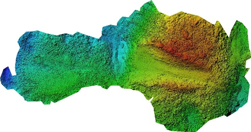
  • Digital Terrain Models (DTM)
  • Contour Charts
  • Volume Calculations
  • Seabed Classification
  • GIS Data Integration
  • 3D Visualization
Bathymetry Applications
Our bathymetric survey solutions support a wide range of applications across diverse industries and sectors.
Marine Navigation
Channel surveys, harbor mapping, and navigational safety assessments
Offshore Industry
Pipeline routes, platform placement, and seabed surveys
Environmental Monitoring
Habitat mapping, sediment studies, and coastal management
Coastal Engineering
Marine construction, coastal protection, and dredging operations
Research Institutions
Oceanographic research, geological studies, and scientific mapping
Infrastructure Projects
Bridge construction, tunnel routing, and waterfront development
Why Choose Teqroniqh for Bathymetric Surveys?
Expert Hydrographers
Our experienced survey team provides professional guidance throughout every stage of your project.
Accurate & Reliable Data
We deliver high-precision bathymetric data that supports confident decision-making and project success.
Customized Solutions
Every survey program is tailored to meet the specific operational and environmental requirements of each client.
Complete Technical Support
From survey planning to data delivery, we provide comprehensive technical support and expertise.
Advanced Technology
We utilize the latest survey equipment and processing software to deliver high-quality results.
Precision Underwater Mapping for Informed Decision-Making
At Teqroniqh, we are committed to providing precision bathymetric survey solutions that deliver comprehensive underwater mapping for engineering, environmental, and scientific applications. Our surveys provide the accurate seabed data needed to support safe navigation, sustainable development, and responsible environmental management.